- Philip Cote: 8th Fire
- 1791 – The Baseline Survey
- 1793-1812 – Brockton’s First Landowners
- 1851 – Map of the Township of York in the County of York, Upper Canada.
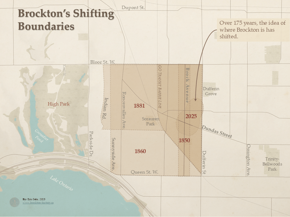
- 1850-2025 – Brockton’s Shifting Boundaries
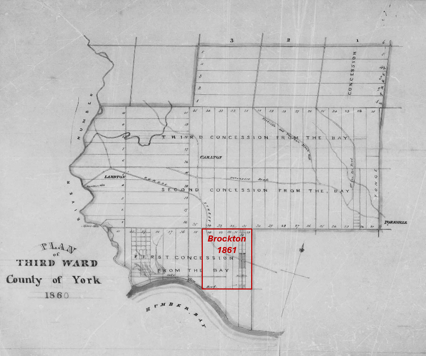
- 1860 – Plan of Third Ward County of York
- 1861 – Black Houesholds in West Toronto
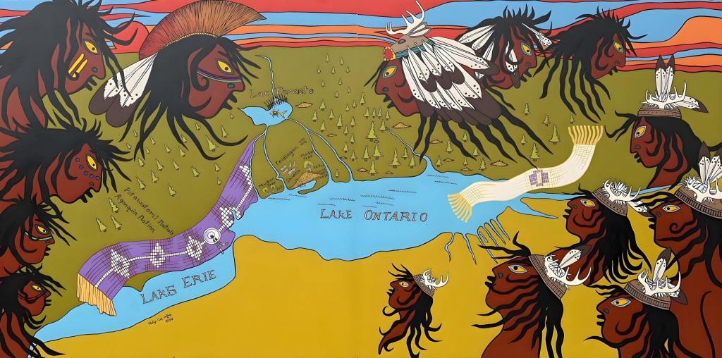
Philip Cote: 8th Fire
A mural and map by artists Philip Cote, showing the Indigenous history of the Greater Toronto area, displayed at 1637 Dundas Street West.
Featured in: On Indigenous Land – Connecting Brockton’s Past and Present through Art
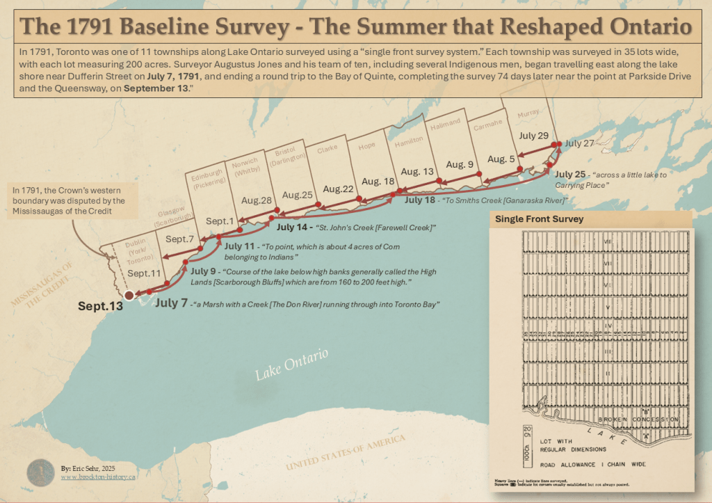
1791 – The Baseline Survey
In 1791, British officials undertook a survey that would establish the basic boundaries for 11 Townships, including those that would shape Brockton: Queen Street, Dufferin Street, and Bloor Street.
Featured in: Making Indigenous Land into British Property: The 1791 Survey That Shaped Ontario and Brockton
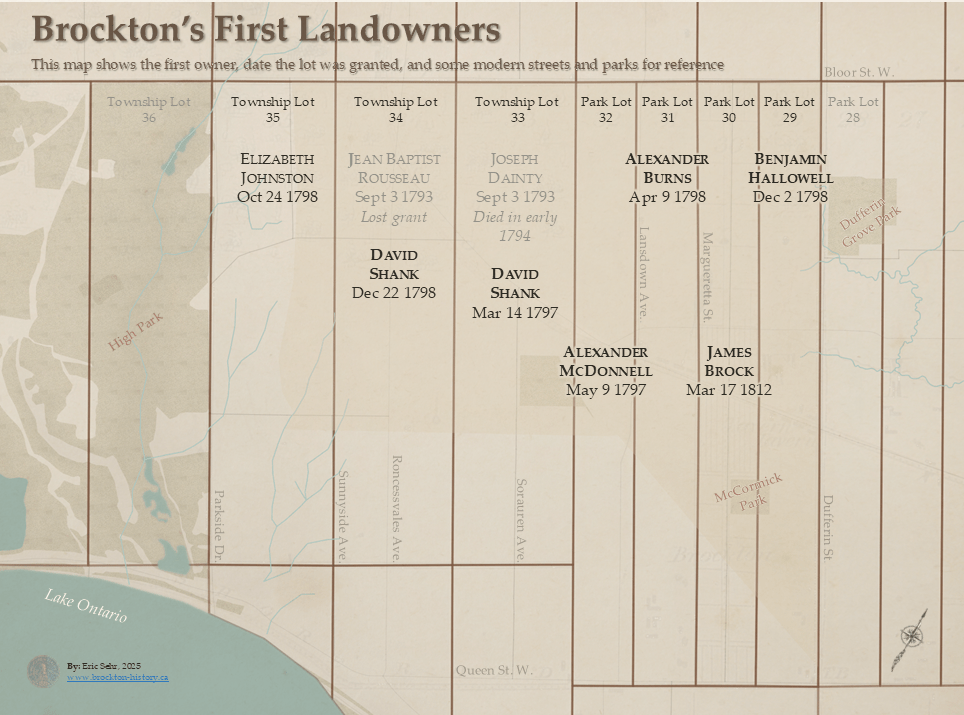
1793-1812 – Brockton’s First Landowners
Featured in: The Sheriff, Secretary, Commander, Widow, and Father-in-Law and Who Got the Land? Reading Land Petitions from Brockton, Toronto (1796-1812)
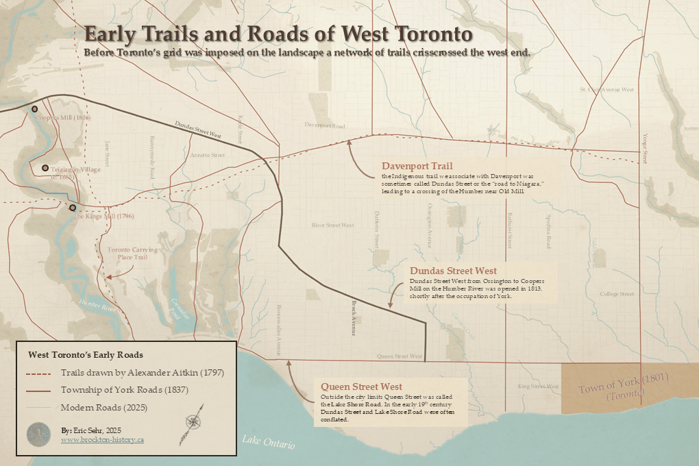
Early Trails and Roads of West Toronto
Featured in: Dundas or Davenport? The Mysterious Origins of Toronto’s First Great Western Road
1851 – Map of the Township of York in the County of York, Upper Canada.
The earliest map where “Brockton” is labelled.
Featured in: Finding Brockton on the Map
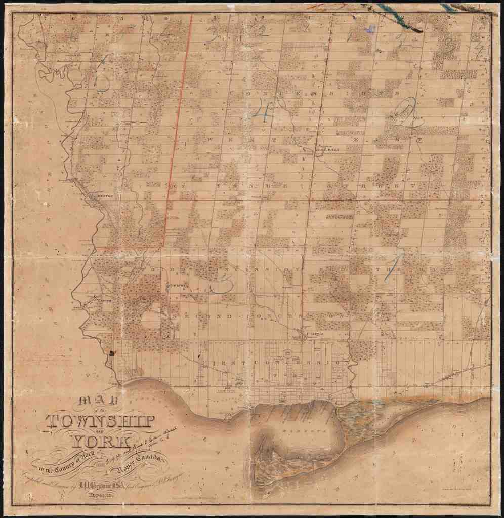
Source: Original image scan courtesy City of Toronto Archives: Series 443, File 40. Winearls, MUC no. 2215
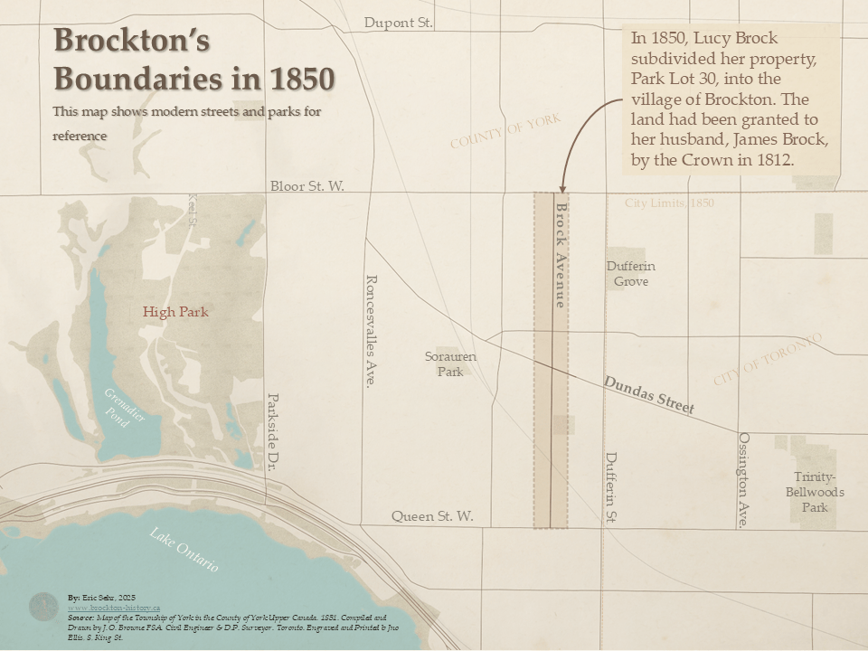
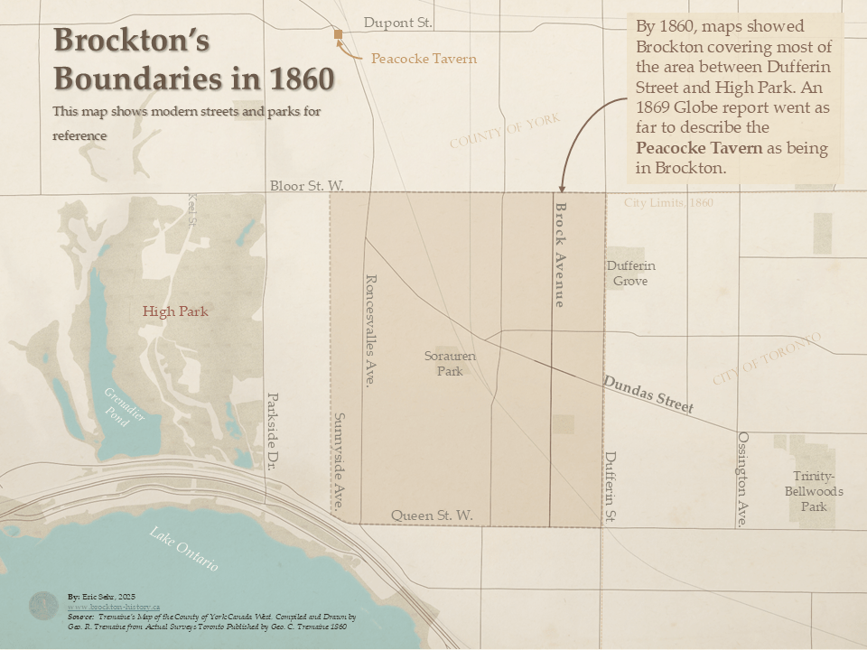
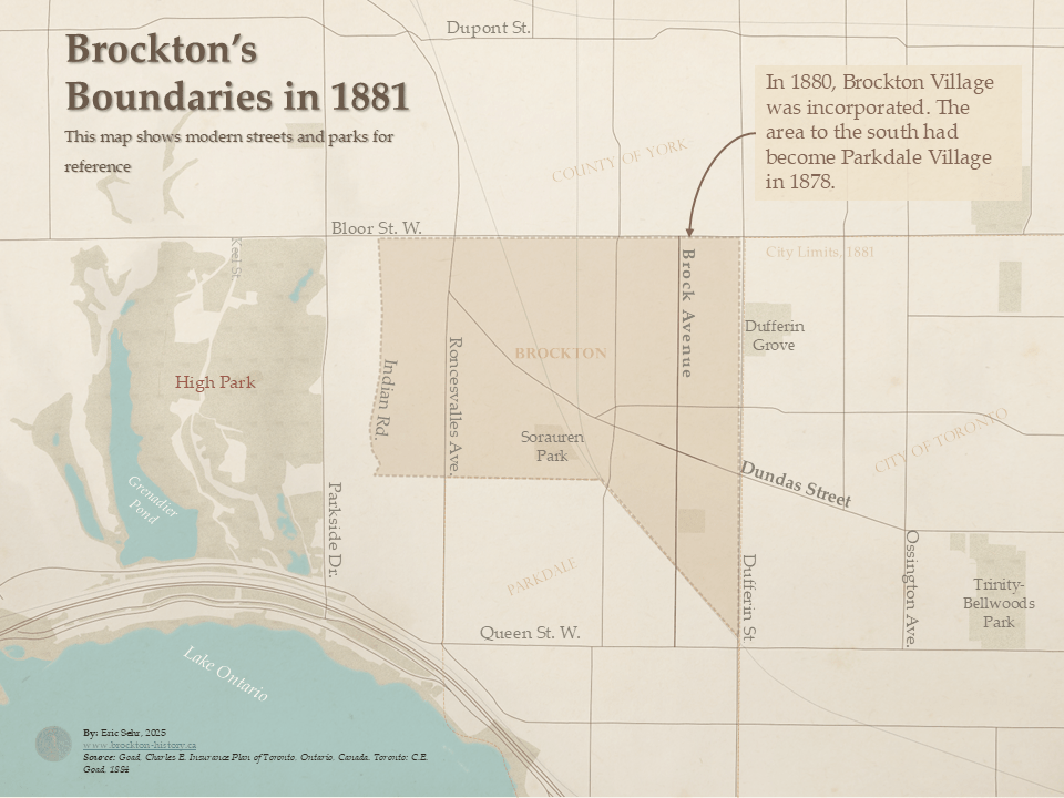
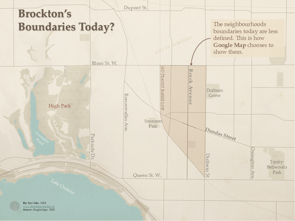
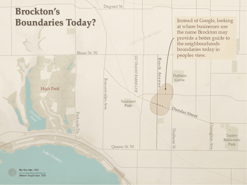
1850-2025 – Brockton’s Shifting Boundaries
Featured in: Finding Brockton on the Map
1860 – Plan of Third Ward County of York
Featured in: Mapping Black Households in West Toronto, 1861: What the Census Reveals
1861 – Black Houesholds in West Toronto
Featured in: Mapping Black Households in West Toronto, 1861: What the Census Reveals

Black Households in West Toronto, 1861. This map visualizes Black households recorded in the 1861 census across West Toronto and York County, including Brockton Village, Seaton Village, and St. Patrick Ward. Locations are inferred from census records and directories, highlighting the distribution of Black families in the area.
